Showing posts with label Bell Mountain. Show all posts

Sunday, September 18, 2016

Trip Report: The Clapper (10,740), Lemhi Range, Idaho

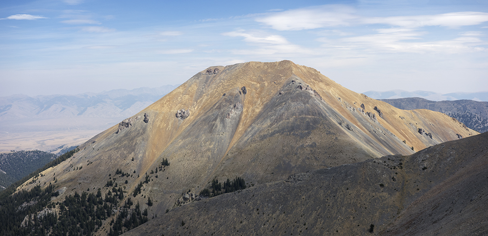
Bell Mountain on the left. The Clapper on the right

  • September 17, 2016
  • Team: Ben Prescott and myself
  • Summit: 
  • The Clapper
  • Route: Southwest Ridge north of Deep Creek
  • YDS: Class 2
  • Total Elevation Gain: 3,786 feet
  • Total Miles: 6.04 miles

Ben climbing the foothill north of Deep Creek
Looking for a simple hike/climb that puts you on top of a Lemhi peak with great views of Bell Mountain? A hike that gains an average of only 1,250 feet an hour/mile? No difficult terrain? Crosses three distinct zones: grass, timber, and alpine. An up and back time of around 4.5 hours at a leisurely pace? The Clapper is perfect. 

During the climb, I often thought this would be a great training destination for a runner. The terrain is simple enough to run without worrying about twisting an ankle and offers a six mile round trip with about 3,800 simple feet of gain. I also thought that this would be perfect for skinning up in the winter. Only the last 600 feet becomes bit more complex with talus, though the rock is very stable.

A 2 hour drive from Rexburg puts you at the trail head. Albeit that was the time on our return trip when I was cruising pretty good through the desert back to the highway; we were both thinking about pizza and pop in Mud Lake. 

To get there, head north on the Little Lost River Highway to Clyde. A large sign on the east side identifies Clyde. Just past the sign, cross the stream and then hang a right and drive across the Little Lost River. Turn left and drive on a relatively good road by Lemhi standards. I followed the road to Foss Mountain and then turned left at the oasis. I drove until I found a good route up a ridge just north of Deep Creek.

Hiking through sagebrush and grass, Ben and I made our way toward the timber line. The grade was gradual and easy. Once in the trees, the ridge continues northeast and levels out from time to time. There is a high point on the ridge (10,095) that we went around on the right. Looking again at the map, a left course may be a bit better. rounding this point, The Clapper came into view. 

10,095

overlook before skirting the slope leading to a broad saddle at the base of The Clapper

First view of The Clapper
Lemhi Crest south of The Clapper
Before the final 700 feet, on the saddle, the views of Bell Mountain were wonderful.


An easy push puts you on the summit. Ben and I spent sometime on the top taking in the views and making some images and then booked it down.

View of Bell Mountain from The Clapper
Ben on the summit

Lemhi Crest from left to right: Peak 10,681, Peak 10,751 (Midway Mountain), 10,737 (Little Brother), Big Sister
Southeast ridge of Bell Mountain and Umpleby
The Ridge of The Clapper

Sunday, August 28, 2016

Trip Report: Lemhi Enchainment, Little Sister to Foss Mountain

High Point on Little Brother (10,737)

  • August 27, 2016
  • Team: Solo
  • Summits: 
    • Little Sister
    • Big Sister
    • Little Brother (10,737)
    • Midway Mountain (10,751)
    • 10,681
    • Foss Mountain
  • Route: Mud Springs to Lemhi Crest
  • YDS: Class 2
  • Total Elevation Gain: 7,310 feet
  • Total Miles: 13 miles

A Class 2 Grand Slam and a Double

Drove to Mud Springs Friday evening. Arrived just before dusk. The hazy conditions did not bode well for photography so I just bedded down for the night. Slept under the stars. Watched the sky darken and the pin pricks of light appear. Mars and Saturn shone brightly in the southwestern sky long before stars and the Milky Way lit up the dark night. The faint white noise of crickets hummed in the desert silence.

Woke up at 4:30 and thought once about beginning the hike. Just once. Fell back asleep and woke at 6:30. Boots on the ground at 6:50. The goal was to make Little sister and then head for the main crest. Next, continue north as far as 10,681. From there I would head west along the ridge to Foss Mountain. Drop off Foss and hike back to Mud Springs.

From Mud Springs, I hiked up the gentle ridge shown below. The goal was to thread the space between the two sets of cliffs near the top. Once past this point, a rocky ridge leads to the lower slopes of Little Sister. At the end of the ridge, I came across what looked like a rusty gold pan. Decided to hang it in a tree marking the route up Little sister.

The way to Little Sister
On top of Little Sister
Big Sister looms ahead
The Lemhi Crest. The goal was to make the pointed peak on the left and then head west

Dropping off Little Sister I spooked 5 or 6 mountain goats. They fled up the rocky slope making a galloping ruckus in the shale.

Goats disappearing over a ridge
Little Brother (10,737) was next
Heading north off Big Sister, 10,737 was next. The Idea of calling it Little Brother just seemed fitting. For me have a moniker to remember the peak is just easier to remember and talk about than a number. Having Big Sister stand between both Little Sister and Little Brother was in keeping with the family theme already in place. Those who know Ben might agree. 

On the ridge, I passed this interesting rock. A large slab of limestone sits balanced on an outcropping. How in the world?

The Lemhi's own Balanced rock
I determined the high point of Little Brother to be this rock, and, yes, climbed out to touch the top.


Looking south towards Diamond Peak

The next summit would be 10,751. I was in the name game mode and dubbed it Midway Mountain because of its location about midway between the 2 most notable Lemhi Peaks: Bell and Diamond.

Midway Mountain (10,751)
Two views of Rust Peak along the way.

Rust Peak

Rust Peak
The next destination was 10,681. It was the most impressive of the enchainment. Yet, I was without another name. I made several images of this peak:


10,681

10,681

10,681

10,681

10,681
Heading east now, I made for the long west ridge in the above photo.

West ridge of 10,681
Made an image of Bell Mountain and The Clapper in the foreground.

Bell Mountain and The Clapper
Looking back at the route, I made these images:

Little Sister far right and Midway Mountain center left. The rise on the right does not have 300 feet of prominence.

Midway Mountain, Little Brother, and Big Sister

Ridge line from Little Sister to Big Sister and Little Brother on left
The east ridge from 10,861 leads directly to Foss Mountain.

Foss Mountain center mid-ground
There is an actual road that one can drive to the top of the mountain. I came across it and followed it for a bit and then took a more direct line to the summit. Once summited I now needed to descend southwesterly and meet the road for an easy path to the mouth of the canyon. My map showed a possible route between 2 sets of formidable cliffs. I got really lucky with this descent. I found a scree run that was perfect for sliding down the mountain. Then, with some moderate bushwacking, I found the road and the way out.

Looking back at the face I came down
 Coming out of the canyon I was impressed by this very thick oasis.

Spring at the canyon mouth leading up Foss
I began the long walk over the foothills back to Mud Springs. Often following faint roads or stepping through sagebrush, I headed south. the hike was punctuated by several lush areas fed by small springs. Although, barely a trickle this time of year, the areas were surprisingly verdant. I did see 5 more mountain goats on the upper foothills and counted myself lucky to come across such magnificent animals.

Looking back at Foss Mountain
The rolling foothills pushed my total elevation gain to over 7,300 feet and the distance to 12.97 miles. Finally I saw the green line of Cedar Run Creek in the far distance. I had rationed my 3 liters of water to just make it back to the truck and was motivated to reach the cooler and down a cold Mountain Dew Kickstart and a protein drink.

The line of cedars in the distance leading to Mud Springs
Reaching the car at 5:40 gave me plenty of time to make it to Mud Lake and order a Hawaiian pizza before the pizza joint would close at 8:00 P.M. Perfect timing and a perfect day. 


Finally, had a rare optical experience driving across the desert. Artists and photographers are keenly aware of different changing light temperatures from dawn to dusk. For example, Monet was a master of seeing the light for what it is. Most people never have the optical experience of seeing the light because of an overriding auto white balance in the brain. 

For some reason, I was able to really see the light that evening. Artists know that as the sun sets and the colors change, the shadows cast by the sun will appear as the complement of what ever light the sun and atmosphere transmit. That evening the sun set in the smokey haze from the numerous wildfires in the area. It glowed red. Hence the shadows of objects should be a vivid green. Most will never actually see this as their brain prevents this visual feast. However, that evening as I drove across the desert, I was ecstatic to see the shadows as green as can be. Wow! a final treat to a great day.


GPS Track from Mud Springs

Sunday, May 15, 2016

Trip Report: Meadow Peak (10.633), Lemhi Range, Idaho

Meadow Peak Summit Ridge
  • May 14, 2016
  • Team: Fred Wooley, Scout Troop 418
  • Summit: 
    • Meadow Peak
  • Route: East Face
  • YDS: Class 2
  • Total Elevation Gain: 2,690 feet
  • Total Miles: Approximately 5.5 miles
This May has been cool and wet. When the weather forecast predicted a small window of sun for the weekend, we decided to make the most of it by taking some scouts up Meadow Peak. I picked the mountain for its gentle class 2 east face with two large plateaus on the way to the summit. That way I did not have to worry too much about thirteen-year-old boys running around on a mountain and could just enjoy the hike.

To get there, head north on highway 28 up Birch Creek Valley. Pass the turnoff on the left to Mammoth Canyon and the turnoff on the right to Nicholia. Then take the left turn to Meadow Canyon. The road then continues west to the mountains. Just before dropping down into Meadow Canyon, hang a right up the hillside and then find your way to the large red something, perhaps a water tank. The red cylinder sits at the foot of the east side of the mountain. 

We drove to the mountain Friday after school and made camp near the base of the mountain. Driving across the desert, I was reminded of how massive and beautiful The Incredible Hulk is, I stopped and made some images of the mountain.

View of The Incredible Hulk driving in

View of The Incredible Hulk driving in
Once at the foot of Meadow Peak, some kids set up tents. A few laid out bags under the stars. Fred brought a few pounds of marinated turkey breast that he had recently butchered with several of the boys. He mixed this with several kinds of beans and spices to make an evening meal. 
Campsite

The boys threw a football around and played kick the can as the evening light faded. I took this opportunity to make images of The Incredible Hulk to the south. I wandered around the base of Meadow Peak to get a good vantage and made the following images.


I also made an image of the Birch Creek Valley in the evening light from out campsite.


The route up Meadow Peak is straight forward. Head up the face and find the ridge to first plateau. Cross the flat and then continue up the steeper face of scree to the second plateau. During this scramble, the boys were thrilled to find Horn Coral. The abundance of intact horns made them picky as to which one they would keep. Most went home with a near perfect horn.

The summit sits about 600 feet beyond this second open space. The most obvious route to the top is the ridge on the south end of the peak.


Two scouts approaching the southeast ridge
Matthew Erikson and Cameron Ricks below the summit ridge

The Summit Ridge

Meadow Peak is not a photogenic mountain. Its two wide intermediary plateaus set the summit far back from the foot of the mountain. To photograph the entire mountain one must be a considerable distance to see the actual summit. Although the south face is dramatically punctuated with dizzying cliffs, the east face is unremarkable. I think most climb Meadow Peak not for its aesthetic qualities but for the views to be had on the top. This day the views did not disappoint. 

Neil Clifford, Cameron Ricks, Ben Prescott, and Matthew Erikson on the summit looking north
Cameron Ricks and Matthew Erikson on the summit ridge
Bell Mountain with Meadow Peak's snow covered ridge in foreground
Bell Mountain and Peak 10,720+ (The Clapper) on the left

Saddle between Peak 10,720+ and Bell

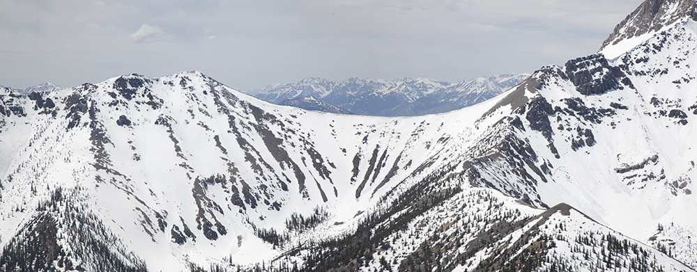
Several point-release and one slab avalanches on the northeast face of Bell

Bell Mountain
One final image of the trip is of the north face of The Brow. I have an interesting connection to The Brow. While coming off the northeast ridge on my way to Lame Jake, I experienced my first real-time avalanche off the north face. The memory of the slide slamming into rocks below and exploding into the air was an incredible sight and a reminder of how powerful even small avalanches can be. Anyway here is the impressive north face of The Brow.

The Brow, north face