Showing posts with label Lost River Range. Show all posts

Wednesday, March 16, 2016

Trip Report: Mount Church, 12,200 ft, Lost River Range, Idaho

  • March 12, 2016
  • Team: James Helfrich, Meieli Allen, Brenda Cude, Myself
  • Summit: 
    • Mount Church, Attempt
  • Route: Drainage north of Jones Creek via Lone Cedar Creek Road
  • YDS: Class 3
  • Total Elevation Gain: approximately 5,500 ft.
  • Total Miles: approximately 13 miles

Left: Brenda Cude approaching Donaldson
Right: Me taking the photo of Brenda, James Helfrich photo
The idea of a winter ascent of Mount Church has been rattling about in my thoughts ever since I saw a photo of someone making the snow covered summit. The climber and the peak could have been taken in some exotic range anywhere in the world. In my small sphere, it was the sum of mountaineering in the most romantic sense.

After last month's summit of Daisy Black during an attempt of Tyler Peak in the Lemhis, the Daisy Black group decided that a winter summit of Mount Church would be a respectable challenge. A date was set for March, and we anxiously looked forward to the climb.

The day came to depart for the mountain and the group dynamic changed. Jeremy opted out because of illness and James Allen decided to stay home with sick kids and send his wife Meieli. Along with Meieli came her friend, Brenda Cude from Ashton. Both Meieli and Brenda were upbeat and strong. Their effervescent personalities added to the demeanor of the team. 

We drove over to the Lost River Range after work on Friday. Stopped at Pickles for dinner before continuing to Lone Cedar Creek Road and the trail head of the drainage north of Jones Creek. We were in our bags by 8:30 with a 4:00 A.M. wake up time. Despite plenty of time to sleep, I was extremely restless. Still awake at 12:30, I just gave up on the idea of sleep and decided there were worse things in life than climbing a mountain with no sleep. Freed from the pressure to sleep, I think I dozed off for a couple of hours before the 4:00 A.M. alarm.

The early morning sky looked promising. Patches of stars shined brightly through a broken cloud cover. We knew we would be rolling the dice with the weather and were encouraged by this good omen. We dressed, ate a quick breakfast, and were on the trail by 4:45. The route follows a drainage east into the mountains. There is a trail that avoids serious bushwhacking but the snow and darkness made it difficult to find. We often zigzagged up the stream bed through thickets and trees. There is no wrong way up, but when we did find the trail, the hike was much more enjoyable. 

With morning light, we were greeted by the beauty of the narrow canyon. The snow was often deep and trail blazing was slow, but the solitude and views were rewarding.

Breaking trail up the drainage, James Helfrich photo
Meieli breaking trail using the swimming technique, James Helfrich photo
Coming out of the canyon, James Helfrich photo
Once out of the canyon, we noticed the low cloud level ahead. Just the lower bands of rock on Church were visible. We knew that the route would take us to the south round the face of Church to the ridge between Church and Donaldson. Just how far to go and how high we should make our traverse was guess work as landmarks disappeared in the fog and occasional snow flurry.

Finding the route to the upper cirque below the head wall, James Helfrich photo
James had been on this route several times before and had a good sense of where we were. His navigational skill proved to be extremely valuable. Once in a while more of the mountain would appear and we corrected our course accordingly. Soon we found the rocks of Donaldson and knew that the head wall was in our reach.

Heading to the upper cirque, James Helfrich photo
Finally the entrance to the upper cirque lay ahead. We guessed that the entrance was marked by the rock on both sides. GPS later confirmed our hunch.
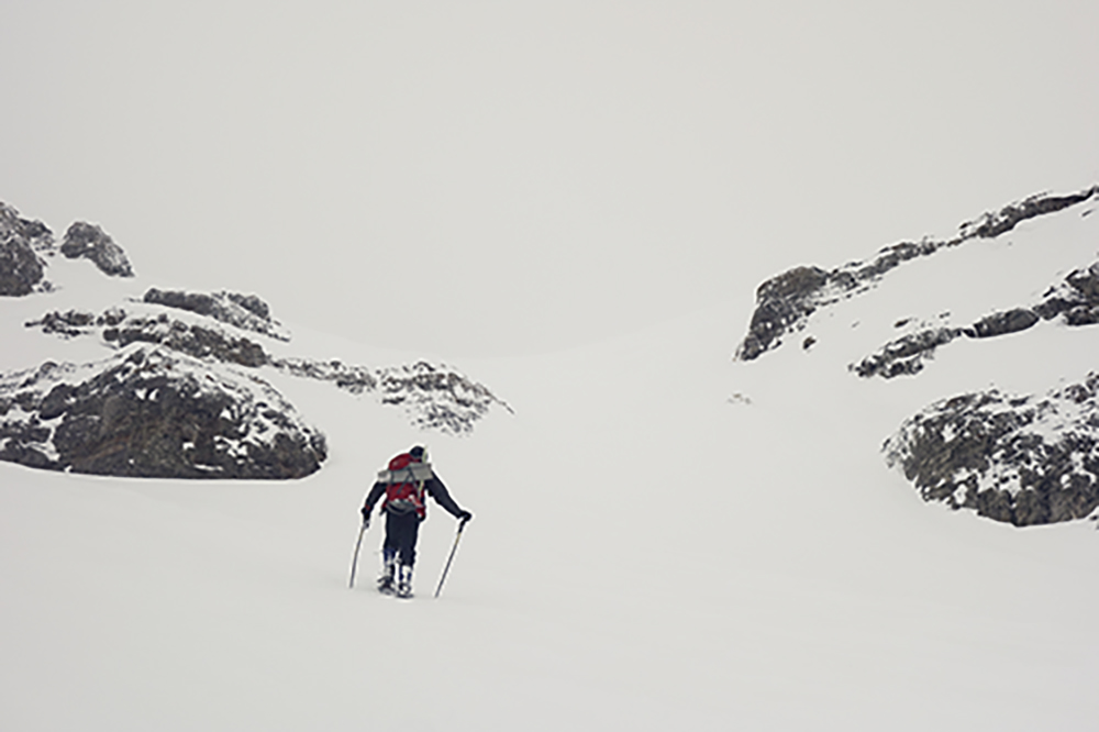
James Helfich entering the upper cirque
The first crux of the climb, we knew, would be navigating the maze of cliffs up the head wall to the upper ridge. The second crux would be walking the exposed ridge to Church. The ridge would require several short climbs on rock and snow with great exposure. Now we were confronted with the real possibility of not even being able to plot a line up the wall due to the whiteout we found ourselves in.

Increasingly poor visibility, James Helfrich photo
We plodded ahead with the remote chance the clouds would break. Despite the thick fog, other conditions were near perfect. The temperature was moderate and the wind was little to none. The snow was just right for snowshoes. At one point we decided to wait out the fog. we layered up and rested. We discussed the option of climbing the wall if visibility became better. Even if we could make the ridge, we concluded that this may not be prudent. There was the real possibility of being on the ridge and having the clouds roll back in. Trying to thread our way, down climbing, through the maze of cliffs on the wall without seeing would be tense to say the least. At a little over 11,000 ft, we decided to turn around.

Hustling back to the canyon, James Helfrich photo
We jetted down the canyon and back to the car. Once on Highway 93 we had a good look at where we stopped just below the wall. We all felt strong and knew that had the timing and weather been better, the summit would have been a good possibility. We did revel in the chance to be out in the mountains as a group. It was a beautiful day and the experience of being in a white void was aesthetically unique. All in all a great time.


Below the Head wall between Church and Donaldson
We stopped in Mackay for dinner at Mary Lou's. I ordered a rib-eye medium rare. The steak was a perfect meal after the outing. 


Sunday, April 26, 2015

Climbing White Cap Peak Trip Report, April 24, 2015

White Cap Peak from the West Fork of the Pahsimeroi
Taken in June


This photo taken in July of the same year shows both the ascent and descent routes of the climb

Last week someone ask me if I ever get lost. I replied, "Not really, there are only two directions, up and down when climbing." Although this is an oversimplification, Its simplicity is often not far from the mark. When climbing you are always looking for a line that will lead you to the top and then for a line that will get you back down. Sometimes they are the same route and sometimes not.

Scott Gifford and I were on the road to the Lost River Range at 4:40 A.M. Saturday morning. The forecast called for snow but only light wind. We felt good about the day ahead. As we approached Mackay, the morning light illuminated the hills and mountains along the way. We stopped a few times and made some images. It was super nice to be with Scott at this time. Scott is a photographer and understands that to make good images requires time, thought, and patience. It was good not to feel like I was a nuisance stopping just to "take" some pictures.

Little Mac, Mount McCaleb, and USGS Peak

Mountains to the southwest of Mackay

Mountains to the southwest of Mackay
Lost River Range south of Mackay
I believe Invisible Mountain is on the left in the clouds
We drove a bit further north and made a few more images. The morning was beautiful. The new snow on the taller peaks and wonderful light made it easy to appreciate where we live. I know there are more exotic and majestic vistas, but we just felt lucky to have these mountains within a few hours drive from home.

Lost River Mountain with the false summit and ridge leading to the summit

Breitenbach in distance and Lost river on right
Herd of Elk, Sawmill Gulch

We approached the White Cap climb via Sawmill Gulch. The turn off to the right, while driving north out of Mackay, is well marked. The road condition starts off well and gets worse the farther you go.  My Forester kept climbing well into the canyon. Scott concluded the road must have been an old mining road. After the climb, while returning to the car, we came across a massive slide of tailings and could see the slope that was washed away in the operation. This discovery confirmed his suspicion.

Mining tailings coming from the above slope
At this time the snow at this lower elevation had melted in the early afternoon
The road eventually became too steep and rocky for the Subaru. We backed down a bit to a more level place to park and got ready to hike. The new powdery snow was an inch or two deep where we began walking up the road and made it look like a fresh winter morning. Hard to imagine it could have been more beautiful.

Early view of the valley
From where we began we did not have a vantage of White Cap. We just knew we need to go up. The road kept ascending so we just followed it and looked for a good line to veer off on. the beautiful weather in the morning was changing. Dark clouds were rolling in and distant views were slowly obscured with fog.

Bad Rock Peak and Mount Church before they disappeared in the fog
We eventually chose a peak to climb knowing that once on the upper ridge we would have a good view of where we were going. As beautiful as the snow was, the few inches made the rocks extremely slick. looking for a way up, we chose from two lines of snow gullies to avoid the steep slope of slippery rocks. One route went to the ridge to the south of the summit block (green route below) while the other wound around the summit and led to the north west ridge (magenta route below). The gully of snow in the later route cannot be seen from this view snapped later as we were hiking back to the car. We chose the magenta route. In hind sight the green route would have been the best choice for the most direct route leading to White Cap. Yet, the magenta route provided us with a bit more technical experience. This was the only class three section of the climb. It is interesting to note that on my topo map the elevation of this peak is listed at 9,957 feet. As we rounded the block north of the summit, both Scott's and my GPS read that we were over 11,000 and we did not even go to the top of the mountain. Could this be a lost 11ner?

Route as we left the canyon in magenta
Unfortunately, when we made the ridge, we were in the clouds. We couldn't see the peak. We knew White Cap was ahead, most likely to the right, and that Peak 11,967 was connected by a ridge to the left. We had discussed a possible traverse to 11,967 but at this point we just wanted to see where we were going. Fortunately, we had windows of visibility. These moments helped us get our bearings and  gave me the chance to make the only images on the way to the top.

Our first view of something ahead
Ridge between White Cap Peak and Peak 11,967
 When the following view opened, we began to reconsider our traverse to 11,967. The ridge looked extremely gnarly. Perhaps the shifting clouds made it look more ominous than it is. In any case we focused on getting the top of White Cap.

Ridge between White Cap and Peak 11,967
Finally, we got a good look and where we were going and set a course up a gentle slop covered with snow. Our crampons bit nicely and it was a leisurely walk to the top. The final big slope is made up of Quartzite, hence the name White Cap Peak. This prompted a geology lesson from Scott, a geology major. A nice bonus.

We get our first look at White Cap Peak

Even as we were ascending the final slopes of the peak, I still wanted to at least start on the ridge to 11,967. I really just wanted to see how far we could comfortably push ourselves. By this time though, visibility had gone to pot, the wind had kicked up, and it began to snow. One of the reasons to climb White Cap is for the tremendous views of Lost River Mountains and of the West Fork of the Pahsimeroi with Pass lake below. The photos would have been incredible. On this Saturday afternoon, the photo gods just didn't smile down on us. We were content to have reached the summit and with the wind, snow, and cold, I did not even want to start walking north to the "gnarly" ridge.

Scott on the summit
We descended to around 11,000 to get out of the weather and ate a large snack. While going down, we began scouting a line to descend. At first we thought that we could drop off the east/west ridge to the south. When we reached this point, it was corniced and the other side was at about a fifty degree slope. We continued along the ridge looking for a place to drop off. Along this line, there is another peak between White Cap and Peak 9,957. We decided to follow the line to the top, Peak 11,045. Coming off the west ridge, we got a good view of a possible descent route. My first thought was that it looked like a perfect glissade gully that dropped to the canyon below. We slid down the slope and cut hours off our return trip.

Scott glissading down the south side of the east/west ridge.
Next we found ourselves bushwhacking through timber to find the road leading to the car. I have to note that although we were climbing over trees and ducking under branches, the air was calm, the forest was quite, the sound of small creeks came and went, and the occasional snowflake floated down. This was one of the most pleasant bushwhacks ever. Despite not having the views from the top, this was a near perfect outing.

Bushwhacking back to the car

Turnoff from Highway 93 onto Sawmill Gulch Rd.
Ascent route

Descent route
White Cap Peak is such a beautiful mountain that the photos of this trip just don't do it justice. I am including some photos from a June hike Ben and I did to Pass Lake at the base of White Cap from the Pahsimeroi side. The photos show off Leatherman, White Cap, and Pass Lake.

White Cap Peak
Leatherman Peak on left
Ben at Pass Lake
White Cap Peak on right
White Cap Peak
Pass Lake
White Cap Peak
Pass Lake
Leatherman and Pass Lake

Leatherman, White Cap, and Pass Lake

White Cap Peak and Pass Lake

White Cap Peak and Pass Lake
Below White Cap Peak
White Cap Peak

White Cap Peak and Pass Lake

White Cap Peak
White Cap Peak
Other Resources:

Tom Lopez Website: White Cap Peak

For more trip reports of other mountains visit idahoclimbing.weebly.com

Monday, March 30, 2015

Climbing Mount McCaleb, and Little Mac Trip Report, Lost River Range, Idaho

Drove to Mackay after work on Friday. The drive is about two hours from Rexburg. I hoped to photograph both McCaleb and Little Mac before nightfall. The light was not the best nor the worst.

Mount McCaleb is the distinctive Mountain towering over the small town of Mackay. It sports a gnarly looking crown which makes it one of the most recognizable summits in the Lost River Range.

Here are a some Friday evening images made of McCaleb and some nearby peaks.

Little Mac, 11,071, Mount McCaleb, 11,682, Little Mac, and USGS Peak, 11,982 
Invisible Mountain, 11,330 center
Mount McCaleb and Desert 
Peak 10,552 south of McCaleb
Lost River Mountain in Distance With False Summit
Last Light on McCaleb's Crown
I think the most direct route to the base of the Mount McCaleb is neither the upper or lower Cedar Creeks roads; I have been on both. The best way is to turn right on Main Street in Mackay. Proceed to the foothill. Instead of curving right, stop at the green gate. The sign on the gate identifies the road leading up to a communications tower but there is no indication of trespassing. As always, make sure the gate is closed behind you.

I parked on the flats near a small hill to make some photos and bed down for the night. If you have a good 4WD, you could knock off eight-tenths of a mile by actually driving to the tree line. See image above. Although, less than a mile hike up a moderate slope is not too bad of an approach!

The evening was very enjoyable. About an hour after the sun went down, I rolled out a pad and a bag in the back of the Forester and left the hatch open to the fresh air. Fell asleep listening to Ed Viesturs book, The Will to Climb and Coyote calls from Lower Cedar Creek.

Awoke a bit after 6:00. Ate a peanut butter and jelly sandwich, got dressed, and was on the trail by 7:00. The hike is pretty straight forward. I debated the line I should take once past the tree line and decided I would go up the ridge to Little Mac, hoping the light would be good on the northern mountains for some photos.

The Pioneers and Mackay Reservoir
Mackay Mountains and Ridge to Little Mac
Near the Top of Little Mac
The Northern Mountains
Lost River Mountain on right, Donaldson, Church, and (I believe) White Cap

This one includes the false summit of Lost River Mountain, far right
The wind picked up on the ridge and I welcomed the leeward side of large rock formations near the top of the mountain. See image above. There were sparse pockets of snow on the leeward side of the ridge but nothing that required any special consideration. Once at the summit, I ate the second half of my peanut butter sandwich drank some Gatorade and began the descent to the pass between Little Mac and McCaleb. The descent was a bit dicey without crampons. I know; I should have thrown them in my pack; I am a slow learner. The snow had not warmed up and was often so solid that I could not kick in a step, I did, however, bring my axe! I prudently traded my poles for the ax and slowly descended using the pick firmly planted in the surface.

USGS Peak Over the Saddle Between Little Mac and McCaleb
The Summit of Little Mac and Ridge Leading to the Col
Loose Snow/Point Release Avalanches off the ridge north of Little Mac.
Ridge Detail
Once on the pass, I enjoyed the views to the east. The snow was firm enough to walk on comfortably with very few post holes. I decide not to follow the ridge to the top. Instead, I opted for a direct route up the northern face of scree and snow.  I had to pull out my axe only one more time on a snow field. Not sure if I saved much time. Climbing up this face, the wind picked up I could see spin drift rising from ridges in the southeast. Slowly the clouds darkened and lowered, always an ominous sign. I was a bit disappointed thinking that by the time I reached the summit the views would be gone. I made the ridge and walked up to the top.

View From Upper Ridge of Mount McCaleb
Once on top, I ate some cashews and peanut M&Ms. It was about 11:30, and I was in no hurry to descend. I laid down out of the wind and rested for about 10 minutes, hoping the weather would change.  Then, I reluctantly started down. About fifty feet off the ridge, it was like a switch was flipped. the clouds disappeared and the wind died! I quickly ran back to the top for some photos.

USGS Peak 
Summit Ridge to McCaleb
Lost River Mountain (center) False Summit and Ridge to Summit
I left the upper ridge a little after noon. I scree skied to the snow fields and then glissaded down. The snow had softened a bit and was perfect...not hard and icy. When the slope was too shallow to glissade, I was able to take big strides in the softening snow, no post holing, just large cushioned steps! Descending was a pleasure. I was back at my car by 1:45. I left for Arco and grabbed an Atomic Burger and chocolate milkshake at Pickles thinking I could afford the calories. Then headed for home.

Other Resources:

Tom Lopez Website:
Mount McCaleb
Little Mac

For more trip reports of other mountains visit idahoclimbing.weebly.com