Showing posts with label climbing idaho. Show all posts

Tuesday, August 23, 2016

Trip Report: Great Western Peak (10,358), Lemhi Range, Idaho

Great Western Peak

  • August 20, 2016
  • Team: Solo
  • Summit: 
  • Great Western Peak
  • Route: Bartel Canyon
  • YDS: Class 2
  • Total Elevation Gain: 4,200 feet
  • Total Miles: 6.7 miles

It was 2:00 Saturday afternoon. I was antsy. Without too much thought, I grabbed some donuts and water and drove to the Lemhis. I had been saving Great Western Peak for just such a day. In proximity it was the closest, still unclimbed by me, peak in the Lemhi Range. I also knew that the map showed one could drive a good distance up Bartel Canyon. Perfect for a late afternoon climb.

The drive just to get to Bartel Canyon is a considerable feat across the desert. Reflecting back, I think it was about 45 minutes from highway 28 to the trail head. The turnoff is well marked with a brown sign identifying several of the canyons on the east side of the southern mountains. Going into the canyon, the road narrows quite a bit. Expect scratches on the sides of your vehicle if you drive in all the way.

I was on the move around 4:00 and headed up the drainage to find my way. I had an idea of finding a gully that would take me up Great Western. What I found was a drainage choked with trees and brush. There was no way I could guess a turnoff in such a thicket. The one gully that I could see presented a tall cliff face from one side to the other. I thought this must be quite the sight during spring runoff. It also gave me pause to think of coming down such a gully and finding such an insurmountable obstacle.

I conceded to head further up the Bartel drainage. Did I say that this was the mother of all bushwacks? After what seemed forever, I came out in a bowl between 10,194 and Great Western.

The upper bowl

The area was riddled with impressive formations and cliffs

I decided to head northwest to make the ridge. I calculated that the peak was more north than south from this point.

Glimpse of Great Western

Stopped on some rocky outcroppings and rested a bit. Made a cairn on the high point of the ridge. 

Cairn on the ridge to Great Western

North ridge of Saddle Mountain
Splattski on the ridge
Stellar cliffs were all around

Then had a hair brain idea. Why not retrace my steps and stand on top of 10,194. I knew it was technically not a peak but thought what the heck. I reversed course and headed south. Now the idea of bushwacking in the dark pushed out any thoughts of enjoying this tangent. So, I turned around and headed north. This time I stayed the course to the top of Great Western. 

I had tried to climb this mountain from the west ridge last year and encountered a series of impassable cliffs. Now, from this angle, I could see more clearly what turned me around.

West Ridge of Great Western on left

Detail of cliffs

Detail of cliffs

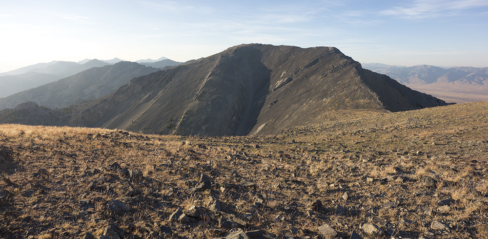
Once on the summit, I could not decide the high point. There is a tall rock outcropping right at the top of the south ridge. However, the east point of the mountain was a possible contender. There was no summit cairn at either location. The only other person I know to have climbed Great Western was Rick Baugher; yet, no cairn. I walked out to the point and gave it my best guess. The rock outcropping was it. I walked back to the top of the rocks and left a register...no cairn...anxious to get down. You can see my dilemma in the third photo above. If anyone climbs this mountain again, build a respectable cairn for the register.

Looking north from the summit
Looking south from the summit

By this time the sun was sinking fast and I quickly dropped off the mountain to a small saddle just at the base of the south ridge. Anxious to get down I descended off this saddle and into the gully. The going was great and I whittled down the elevation quickly. Then came the brambles and the fight began. For some reason a line from the Authority Song played over and over again in my head..."I fought authority and authority won." The thickets got the best of me. Navigated the last hour in the dark forest. Was glad to see the ol' red truck.

Map Track and Stats

Index of Peaks

Thursday, August 11, 2016

Trip Report: Swanson Peak (10,808), Lemhi Range, Idaho

Swanson Peak from the north ridge
Swanson Peak taken in 2015, south ridge

  • August 10, 2016
  • Team: Ben and me
  • Summit: 
    • Swanson Peak
  • Route: South Ridge
  • YDS: Class 2
  • Total Elevation Gain: 4,072 feet
  • Total Miles: 5.83 miles
This summer has sped by without many mountain outings. I busied myself with projects around the home...reworking the irrigation system, building two decks, and prepping for a concrete pad and footing for next year's shed project. I hope to make up for it by getting out as much as possible during the next week. Yesterday, Ben and I went to the Lemhis to climb Swanson Peak and make plans for collecting the summits of Sunny Bar and 10,965. 


Sunny Bar Peak from the north ridge of Swanson Peak

Peak 10,965 and the impressive east face of Nicholson Peak 

We drove to the trail head of Uncle Ike Creek just north of North Creek. To get there travel north from Howe on the Little Lost River Highway. Look for the point where it looks like an ancient slide carried part of the Lemhis to where the road was built. Pass this point and soon you will see the marked North Creek Road. Continue past and get ready to turn right on the next available road. 

The road is very good for Lemhi Standards, although a high clearance 4X4 may be preferred for the last part leading to the small oasis at the entrance to the narrow canyon from which the creek once flowed. A trickle still can be found there; the creek is diverted upstream into a presumable irrigation system. Do not make the mistake of trying to get to the higher green areas to the north. Stay on the desert floor and park in a grassy area before entering the canyon. 

From here it is 2.3 miles to where we left the trail and entered into Sunny Bar Canyon. For this trip, we brought the four-wheeler and made quick work of those miles. Right before the Sunny Bar Canyon you will cross the creek. We made the mistake of trying to bushwhack here through the dense growth and marshy ground. On the return trip, we learned that if we had followed the road just a bit more we would have found a great place to cross the stream. 

The plan was to start a traverse up the western slopes of the mountain. The ground was good and going easy. We made the southern ridge at about 9,200 feet 1 hour and 15 minutes into the hike. The rest was simple, just follow this meandering ridge to the summit. Once we left the tree line, the rocky ridge was solid. The scree/talus was blocky and provided good footing. What could have been a long scree slog was surprisingly pleasant. 

Ben on the south ridge of Swanson Peak
Once on the summit of Swanson, we eyed a high point on the ridge to Little Diamond. Wanting a bit more of a challenge we dropped off Swanson and headed north to what we called Red Shale Point. This ridge was class 3 with several spots of exposure. At one point, we came across an interesting natural arch.


North ridge of Swanson Peak, Red Shale Point in front of Little Diamond Peak
Ridge line between Red Shale Point and Swanson
Arch in ridge
Ridge line looking south back towards Swanson
Ben striking a pose
The high point of the day at 10,922
From Red Rock Point to Little Diamond would be an easy stroll
Boulder Creek drainage to the west
Having reached the day's high point at 10,922, we rested on top of Red Shale Point taking in the views. Heading back, we carefully walked the ridge line. Our goal was to make for the saddle that sits west of Swanson on the ridge leading to Sunny Bar Peak. Once we reached the low spot on the ridge, we began a traverse leading to the saddle. First, we found a game trail that seemed to be going our way. All was well until I dropped off the trail and made straight for the saddle. Here, the challenges began. Traversing the steep slope of rocks was terrible. The rocks were just the right size and shape to roll under each step. Stubbornly, I slipped and teetered to the saddle. Ben was smart enough to stay on the game trail, and, although he gained some elevation, he beat me to the saddle in much better shape.


The saddle between Sunny Bar Peak and Swanson Peak


View looking south from the saddle between Sunny Bar and Swanson, Buckhorn Peak in the center distance

The initial gentle slope leading into Sunny Bar Canyon was a welcome change. We dropped elevation quickly and though how smart we were to have taken this path. Then we came to the dry creek that drained the canyon in the spring. Ben got a good lesson in extreme bushwhacking. Fallen twisted trees, dense vegetation, and irregular rocks challenge our progress. Ben ended up covered in spiky seeds and face planted into a tangle of dead trees. He was not a happy hiker. His hand was scratched and bruised when he caught himself and prevented his stomach, from being "impaled"...his words. 

I was so happy to finally come out of the thickets and walk through tall grass and sagebrush back to the creek. Ben's sprits improved greatly during this last quarter of a mile. All in all, a pretty good day with a summit of Swanson a visit to Red Shale Point at 10,922.


A closing shot of me in front of Little Diamond Peak thanks to Ben

Wednesday, August 03, 2016

Trip Report: Devil's Bedstead East (11,865), Pioneer Mountains, Idaho

Devil's Bedstead East from the Boulder Creek approach

  • July 30, 2016
  • Team: Roldolfo Jodra and me
  • Summit: 
    • Devil's Bedstead East
    • Peak 10,942
  • Route: Northeast Ridge
  • YDS: Class 3
  • Total Elevation Gain: 5,023 feet
  • Total Miles: 9.06 miles
Driving south along Wildhorse Creek the smoke was so thick that I could just make out the mountains on each side to the road. I was to meet Roldolfo Jodra at the Wildhorse Campground that Friday and Climb Devil's Bedstead East the next day from the Boulder Creek Trailhead. I was not excited to climb in the smoke and was already making plans to retreat to the Lost River Range which was smoke free when I passed it an hour ago. One of the compelling reasons I climb mountains is summed up by Robert Adams, a noted photographer, who explains why photographers often leave the trodden path. "it's the view, stupid." The smokey Wildhorse Creek valley was not helping my motivation. 

When I met up with Roldofo, I immediately began to steer our plans to climb in the Lost River Range, explaining it was smoke free. He was not swayed. I resolved that his commitment was important enough to climb the bedstead come smoke or high water. We settled down in a campsite and chatted for the rest of the evening. Roldofo enjoyed a civilized colorful pasta dish. I cordially declined to share in his fare, remembering that I had choked down a Taco Bell burrito 3 1/2 hours ago before leaving Rexburg. When he broke out a dish of sweet cantaloupe, I gave in and was all to happy to share in this part of his meal. It was delicious! We bedded down for the night with the forthcoming trek on our minds. I had wild dreams about wandering through forgotten creek-fed woods with bison, lions, and bears. Crazy.

The next morning we awoke around 5:00 A.M. I looked at the dark sky and could see stars. A good omen. We were at the trailhead at about 5:45 and immediately faced the crux of the day. If we were not entirely awake, we were jolted into alertness when wading through brisk Boulder Creek. I dreaded this early morning part of the journey. 

The year before I had waded the creek in the early spring with high water to attempt a climb of Devil's Bedstead. I made it just about to the first lake when rain and lightening chased me off the rocks and back down the trail. The attempt had been a spur of the moment idea and I was wearing all cotton clothing. The clothing quickly became cold and heavy. Luckily I was wearing wool underwear. I stripped down to my skivvies and trudged through the mud and rain back to the trailhead. Under such conditions I thought I did not have to worry too much about anyone being shocked by an encounter with an ugly old guy running through the woods dressed only in his underwear. Anyway the wool did its job. I was wet but warm all the way back to the creek. This time the creek crossing didn't go well. The already high water was a torrent and took me for a rocky tumbling ride. Dragging myself to the other shore, I quickly made it to the car and heater. This July, the crossing was mild but chilly. 

First good view of the mountain
Roldofo on the trail

The trail to Boulder Lake is in excellent shape and quickly rises through a series of switchbacks. Within an hour we were in the in the basin below peak 10,942. We decided to traverse Southwest along the east slopes of 10,942. Gaining elevation as we made our way in the general direction of the lake at the base of the saddle. We noted that there were several places where we could pass through the cliff bands that guard 10,942 and opted to take a scree filled gully to get above them to see what we could see.

The mountains circling the southern end of the basin
I believe this is Abel Peak in the center
Scree gully leading through the cliff bands
I believe this gully was about the second to the last gully that penetrated the bands. We would have eventually come to the lake below the saddle had we not decided to abandon the traverse and head west and up. This choice, however, afforded us stellar views of the upper basin and an encounter with two local females.

Two curious locals
The lake right below the saddle between Devil's Bedstead East and Peak 10,942
as seen from the cliffs to the northeast
The best place to fiddle with a camera near a precipice is on your rear!
Photo by Roldolfo Jodra
Next, we continued traversing to where we thought the saddle would be. It soon came into sight at about 10,300 feet.

The saddle comes into view
The rest was straight forward. Make the north ridge and go up. To get there required careful hopping through a long series of boulders. We knew the north ridge led up a significant tower along the way. Not wishing to down climb the tower and lose elevation, we circumvented the obstacle by walking around it and up in a spiral-like path. This plan worked perfectly. we ended up back on the ridge at the exact point the other side of the tower intersected. 

The edge of the saddle in foreground, the first bump, the tower, and the summit
Now the tower
The tower looks as daunting here as it did then
Washington Lake from the north ridge

Then next part of the climb entailed hundreds of feet of steep class 3 climbing up blocky boulders. Not terribly difficult but some might find the steepness to be a bit unnerving. 

The slope of the climb
Rodolfo climbing another pitch
Soon, we were on the short ridge leading to the summit.

Rodolfo walking the ridge to the summit 
I actually have a summit photo thanks to Roldolfo
Note the ceremonial deer skull marking the top

Spent about 45 minutes lounging on the top. I was eyeing peak 10,942 and making plans to collect it's summit on the way down. What really interested me was the possibility of a scree slide from its top to the trail some 1,700 feet below. 

10,942 beckons in the north
Borah can be seen on the horizon near the center
The Pioneer crest with Old Hyndman, Salzburger Spitzl, and Goat Mountain dominated the view to the southwest while Lost River peaks could be seen in the east. 

While taking in the sights, I noticed two more climbers coming up the north ridge and knew we would intersect paths on the way down. Sure enough we met. I recognized one as Matthew from the spring outing of the Idaho Summits group on Scorpion Mountain. Interestingly, we learned that they had camped right beside us the night before. This might not seem too coincidental except that the choices for camps sights stretches for miles. We exchanged some information and continued towards 10,942.

10,942 just begs to be climbed
Upon reaching the saddle, storm clouds had built up in the south and the wind was gusting as if to usher in a respectable storm. We agreed that at the first sign of thunder we would drop of the ridge and head for lower ground whether or not we made the summit, then continued hastily up the ridge.

We made the summit in no time! In fact within and hour we had summitted, scree skied, and made the basin floor about 1,700 feet below.

Roldolfo summiting 10,942
On the summit of 10,942
Nice pirate hat thanks to the wind
photo by Roldolfo Jodra
Looking back at the Devil's Bedstead
Let the scree ski begin...more like scree slide
Looking back up the gully I came out of before reaching the main trail
Once on the main trail, it was smooth going back to the trailhead. Below you can find information about our route on Caltopo.